
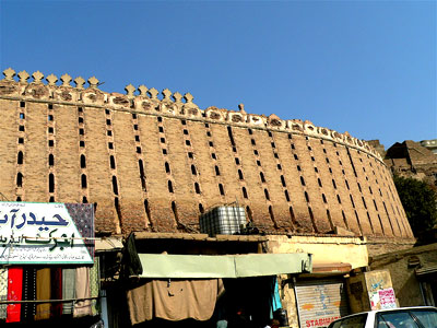
Pacco Qillo Fort (Urdu: پكاقلعه, Sindhi: پڪو قلعو, Strong Fort), formally known as Pacca Qilla, is an early modern fortification in Hyderabad, Pakistan.
Hyderabad (help·info) (Sindhi: حيدرآباد سنڌ, Urdu: حیدرآباد Haidarābād) is the second largest city in the Sindh province of Pakistan. It is the sixth largest city in the country. The city was founded in 1768 by Mian Ghulam Shah Kalhoro upon the ruins of a Mauryan fishing village along the bank of the Indus known as Neroon Kot (Sindhi: نيرُون ڪوٽ). Formerly the capital of Sindh, it serves as the headquarters of the district of Hyderabad. Before the creation of Pakistan, it was known as the Paris of India, for its roads used to be washed with river water.
[nggallery id=54]
How to Reach?
It can be reached by every mean of transportation, be it air, land, water or rail.
Hyderabad has a decent road network, but most of the roads are being redone by the National Highway Authority. Hyderabad is deemed the most important milestone on the National Highway which passes through the city. The highway divides into Route N5 going southwest and M9 going north while it forks into the KLP (Karachi, Lahore, Peshawar, Faislabad) Road and the Hala Road. Over the years, the M9 has had massive construction work to include six lanes across its 136 km span being the most used highway in Pakistan while the N5 has two lanes to cater to its lesser traffic needs. However, the public has stressed to improve the conditions of the roads within Hyderabad.
There are seven large bus terminals within the city. Some of the most busiest are the Badin Bus Stop near SITE, Tando Bago Coach Stop, Jacobabad-Larkana Bus Stop at Pathan Colony, Nawab Shah Bus Stand at Halla Nakka, Sanghar Coach Stop near Civil Hospital, Karachi Bus Stand near Qasim Chowk and Sammi Daewoo Bus Service To Karachi at Auto-Bhan Road and Latifabad U7.
Hyderabad has a rich rail history. From the starting days of the Scinde Railways to the purchase of the private railway company by theNorth-Western Railway now Pakistan Railways, Hyderabad has been a major junction on the rail-line, where railway lines proceed in at least three directions: northwards (up-country), southwards (down-country) and eastwards. The railway station is called the Hyderabad Junction. It was built under the British rule in 1890. The city with increasing need of transport facility is still facing a real trouble with respect to the rail transport. One full fledged while two little stations in detha and tando jam are not satisfying the demands for rail travel.
With the city at the banks of the Indus River, the fishermen tend to use riverboats to fish and travel across the waters. Riverboats are not accessible to general public but local fishermen, in attempts of making money for their daily ration, sail people aboard their fishing ferries at Al-manzar, a restaurant at the banks of the Indus.
Buses and trucks have displaced rail as the principal long-distance carrier. A program of deregulation of the road transport industry was undertaken in 1970 and encouraged the entry of a large number of independent operators into the sector. Trucks and tractor-drawn trailers have largely displaced the traditional bullock cart for local transport of produce to markets, but in many rural areas animal power is still crucial to economic survival. Air transport of cargo and passengers has become increasingly important.
All the main cities are connected by major highways, and Pakistan is connected to each of its neighbours, including China, by road. The great majority of roads are paved. The country’s main rail route runs more than 1,000 miles (1,600 km) north from Karachi to Peshawar, via Lahore and Rawalpindi. Another main line branches northwestward from Sukkur to Quetta.